The Road That Touches the Sky: Your 2026 Guide to the Pamir Highway, the Second Highest Road on Earth
There is a moment on the Pamir Highway when the road stops feeling like a road at all. The gravel narrows, the air thins, and the mountains stop looking like scenery and start looking like weather. You are 4,000 meters up, somewhere between Tajikistan and the sky, and the only other vehicle you have seen all morning was a yak herder on a motorbike. If you have ever wanted a road trip that actually changes how you see the world, this is the one.
The Pamir Highway, known as the M41, runs about 1,250 kilometers from Dushanbe in Tajikistan to Osh in Kyrgyzstan, crossing the Pamir plateau at altitudes most airplanes only reach on takeoff. It is often called the second highest international highway in the world, after the Karakoram Highway, and its highest point, the Ak-Baital Pass, sits at 4,655 meters. This guide covers everything you need to actually do it in 2026: the route, the permit, the real costs, the altitude problem nobody warns you about properly, and a day by day itinerary that works.
What Exactly Is the Pamir Highway?
Forget the idea of a highway. The M41 is a Soviet era military road that was never really built for tourists, and in places it still shows. Long stretches are gravel, washboarded and dusty. Bridges are basic. Fuel stations are rare enough that drivers carry jerry cans. And that is exactly the point. The road follows ancient Silk Road corridors through the Gorno-Badakhshan Autonomous Region, or GBAO, a province so remote and so mountainous that it covers nearly half of Tajikistan but holds only a tiny fraction of its people.
Most travelers drive it west to east or east to west over 7 to 12 days. The classic direction is Dushanbe to Osh, because the altitude rises gradually that way, which matters more than most first timers realize. You start in Dushanbe at roughly 700 meters, climb through river valleys to Khorog, drop into the Wakhan Valley along the Afghan border, then rise onto the high plateau around Murghab and Karakul Lake before crossing the Kyzyl-Art Pass into Kyrgyzstan and descending to Osh.
The scenery changes completely every day. One morning you are driving beside the Panj River with Afghanistan on the other bank, close enough to wave at farmers working the fields. Two days later you are on a treeless plateau at 4,000 meters where the only green is a strip of grass beside a salt lake and the only sound is wind. Travelers who have done both the Karakoram Highway and this road usually say the same thing: the Karakoram is grander, the Pamir is wilder.
Why 2026 Is a Good Year to Go
Two things changed recently, and both work in your favor. First, Kyrgyzstan and Tajikistan reopened their shared border in March 2025, which means the Kyzyl-Art crossing on the Pamir Highway is open to international travelers again after years of closure. The full Dushanbe to Osh route is properly possible again, not just the Tajik section with a turnaround.
Second, the 2026 guidebooks and tour listings are fresh. Central Asia guides updated in October 2026 still list the same core facts, the same passes and the same permit rules, which tells you the route is stable right now. That does not mean you should skip checking conditions before you leave. Border rules and regional access in the Pamirs can change at short notice, so confirm the crossing and the GBAO permit situation with your driver or tour company in the final weeks before departure.
The Route, Day by Day: A 10 Day Dushanbe to Osh Itinerary
You can do it faster, but you should not. Rushing the Pamirs is how people get altitude sickness, miss the Wakhan Valley entirely, and spend the whole trip staring at the back of a headrest. Ten days gives you room to breathe, literally.
Days 1 to 2: Dushanbe to Kalaikhum
Leave Dushanbe early and head east. The road climbs through the mountains to Kalaikhum, a dusty riverside town on the Panj where the real journey starts. Stay in a guesthouse, eat your first Pamiri meal of noodle soup and fresh bread, and sleep low. Your body will thank you later.
Days 3 to 4: Khorog and the Wakhan Valley
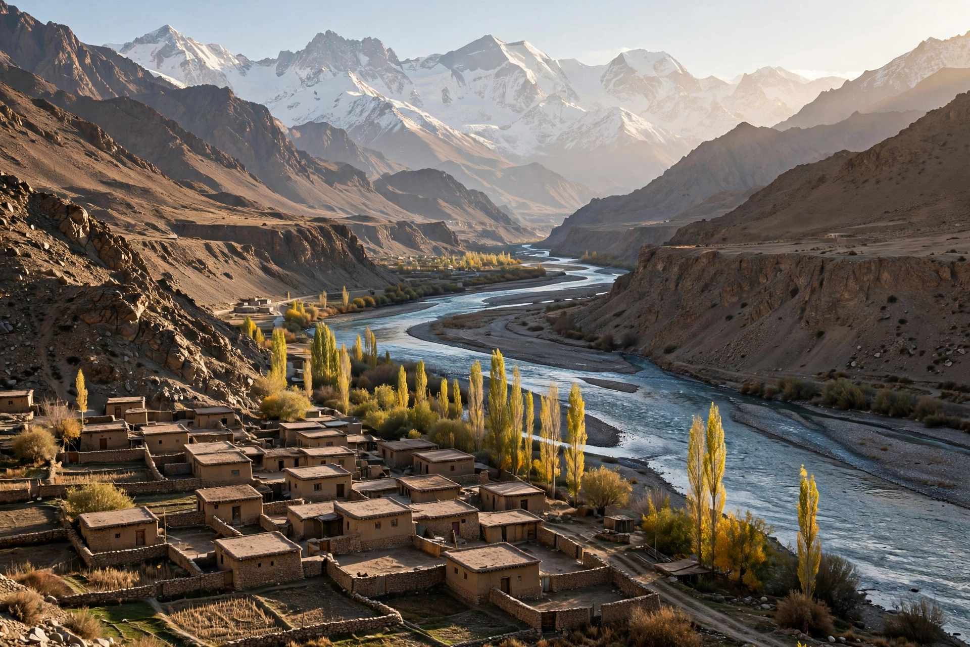
Khorog is the capital of GBAO and the last town that feels like a town. Stock up here: snacks, water, cash, any medicine you need. Then turn south into the Wakhan Valley, the most beautiful stretch of the whole road. The valley follows the Panj River along the Afghan border, past apricot orchards, poplar trees and villages where the houses are built from stone and mud brick.
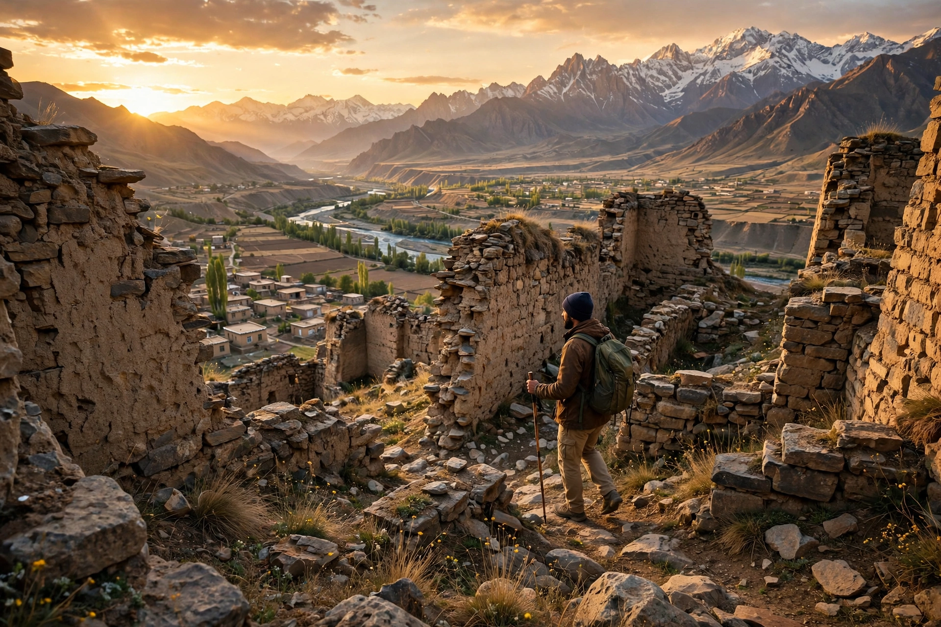
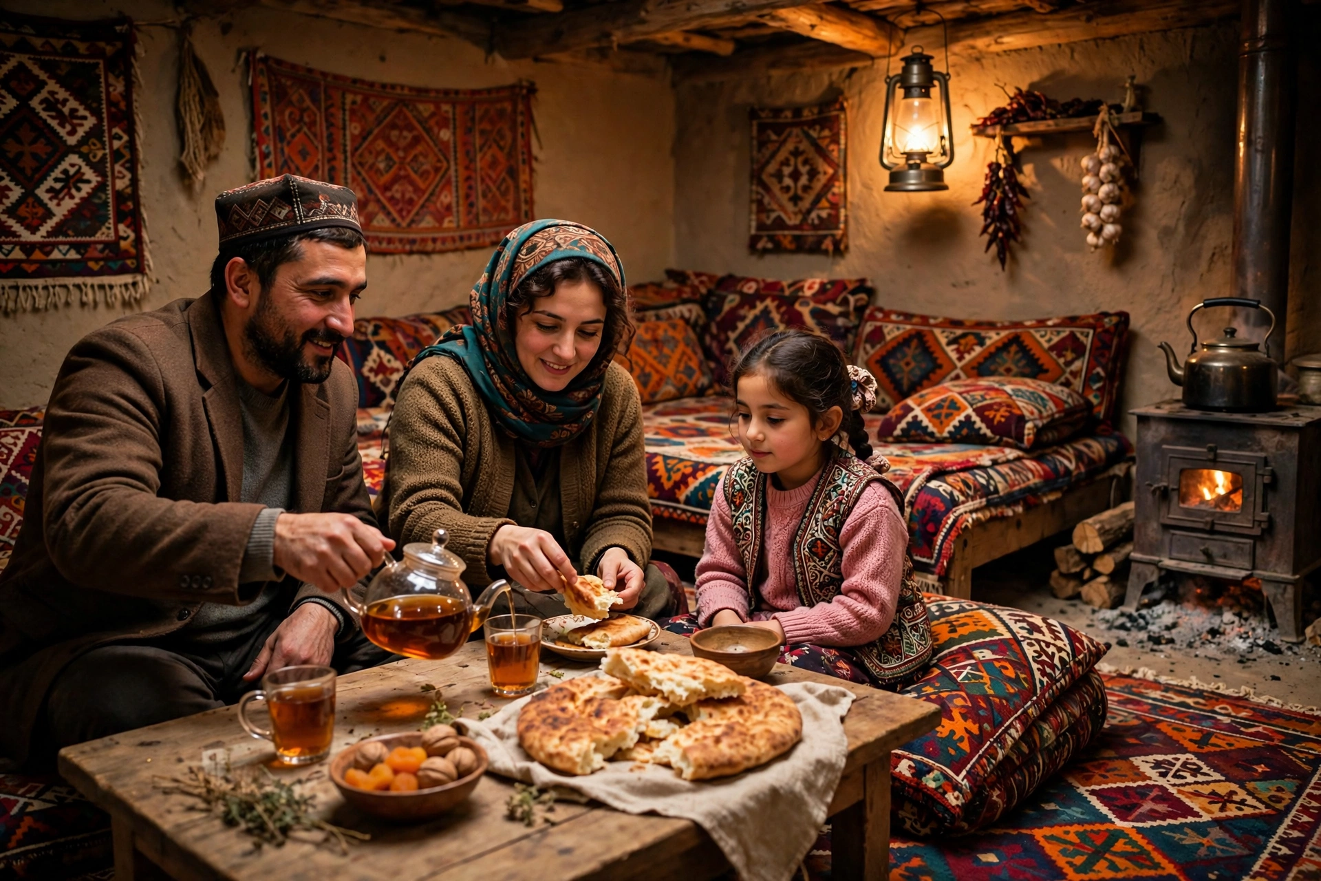
Stop at the Yamchun Fortress, a ruined citadel on a hilltop with views down the whole valley. Soak in the Bibi Fatima hot springs, a natural pool named after a local legend, where the water is genuinely hot and the setting is absurdly pretty. Sleep in homestays in villages like Yamg or Vrang, where families cook for you and the kids practice their English on you.
Days 5 to 6: Khargush Pass, Bulunkul and the High Plateau
From Langar, the road climbs over the Khargush Pass and drops to Bulunkul and Yashilkul, two high lakes at about 3,700 meters. This is where the landscape turns to desert. The air is thin, the colors are brown and blue and nothing else, and you will start to understand why locals call this the Roof of the World.
Days 7 to 8: Murghab, the Town at the Top of the World
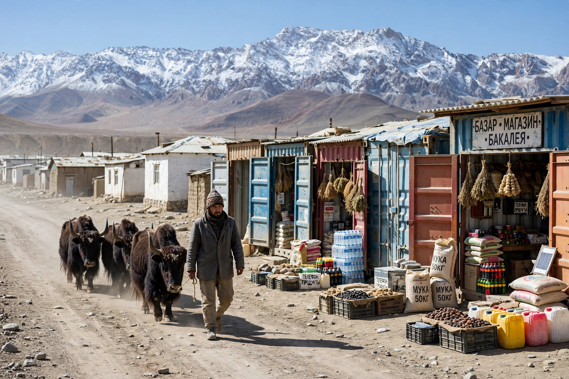
Murghab sits at about 3,600 meters and feels like the end of the earth in the best way. Its bazaar is built from shipping containers, its people are mostly Kyrgyz herders, and its main street is a stretch of the highway itself. Buy yak wool socks. Eat yak meat if you get the chance. Spend a night here to acclimatize before the highest pass, because the next day is the big one.
Day 9: Ak-Baital Pass and Karakul Lake
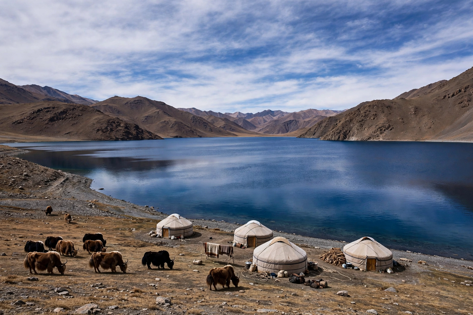
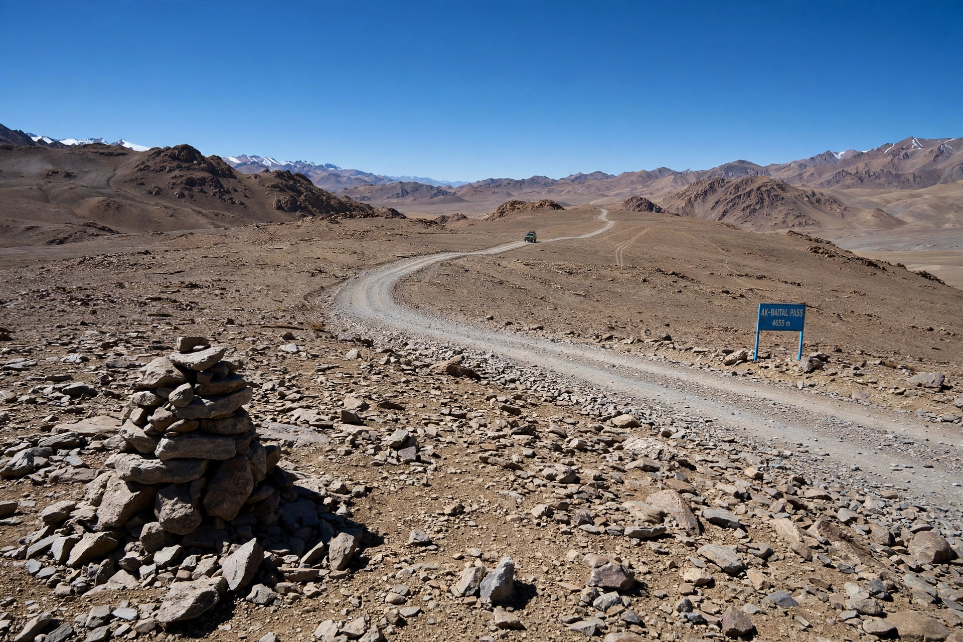
The Ak-Baital Pass at 4,655 meters is the highest point of the journey and the highest pass many travelers will ever cross by road. Stop at the top, take the photo, and then keep moving, because the wind up there is brutal. Descend to Karakul Lake, a deep blue crater lake at nearly 4,000 meters ringed by barren peaks, where yurt camps host travelers for the night. If the sky is clear, the stars here are unlike anything you have seen, because there is almost no light pollution for hundreds of kilometers.
Day 10: Kyzyl-Art Pass and Down to Osh
Cross the Kyzyl-Art Pass into Kyrgyzstan, descend through Sary-Tash, and roll into Osh by evening. Osh is loud, green and full of food after a week of dust and altitude, and that first proper meal in a city restaurant tastes like a celebration. You have just driven one of the great roads on earth.
The Problem Everyone Underestimates: Altitude
Here is the honest problem with the Pamir Highway, and the reason this guide spends a whole section on it. The eastern plateau sits between 3,600 and 4,600 meters. Murghab is at about 3,600 meters. Karakul is at about 3,900 meters. The Ak-Baital Pass is at 4,655 meters. At those heights, altitude sickness is not a rare worst case, it is common, especially if you arrive fast from Osh, where the first night at Karakul is already at about 3,900 meters.
The fix is simple but non negotiable. Travel west to east, from Dushanbe, so the climb is gradual. Spend your first nights lower, in the Wakhan Valley and Khorog, before going higher. Drink far more water than feels normal. Skip alcohol at altitude. Walk slowly, even when you feel fine. And if you develop a severe headache, vomiting, breathlessness at rest or confusion, descend immediately. No view is worth pushing through those symptoms. Diamox is worth discussing with your doctor before departure, and travel insurance that covers high altitude evacuation is not optional on this road, it is essential.
Permits and Paperwork: The GBAO Permit Explained
The second problem that trips people up is paperwork, and it is entirely avoidable. Everyone entering GBAO needs a GBAO permit in addition to their visa or visa free entry. Without it, you cannot legally travel the Pamir Highway at all, and there are checkpoints along the route, particularly near the Afghan border, where guards will ask to see it.
The good news: it is easy to get. Most nationalities can enter Tajikistan visa free for a short stay, and those who need a visa can apply for an e-visa online for about 50 US dollars. The GBAO permit is an add on to the e-visa application and costs about 20 US dollars, though some tour companies quote around 35 US dollars when they arrange it for you. Apply before you leave, print a copy, keep it with your passport, and carry both at every checkpoint. Tour companies will usually arrange the whole package for you, which is one less thing to worry about.
What It Actually Costs in 2026
The Pamir Highway is not a luxury trip, but it is not a shoestring trip either, because the main cost is transport. A private 4×4 with a driver runs roughly 150 to 250 US dollars per day, split between up to four people, which is why traveling as a group of three or four makes a real difference. A seat on a shared group departure is much cheaper: a 7 day Dushanbe to Osh group tour with a 4×4 and English speaking driver starts from about 550 US dollars per person, with homestays and meals paid locally at roughly 28 to 30 US dollars per day.
Full private tours tell the same story at a higher level. An 8 day private Pamir Highway tour is listed from about 1,635 US dollars per person for a group of four in 2026, rising to over 4,000 dollars for a solo traveler, which shows exactly why you want travel companions. Budget on top of that for the e-visa (about 50 dollars), the GBAO permit (about 20 dollars), entrance fees of roughly 40 dollars for the whole trip, and a buffer for surprises, because on this road surprises are part of the price. Cash is king in the Pamirs: there are almost no ATMs once you leave Khorog, so carry enough Tajik somoni for the whole route.
When to Go, and How to Travel It
The season is June to September. July and August are ideal for the Wakhan Valley and the high lakes. May and October are possible but risky, because the high passes can close in snow. Outside that window, the Pamir Highway can close entirely, so do not plan a winter attempt unless you know exactly what you are doing.
As for how to travel it, you have three real options. Hiring a 4×4 with a local driver is the most popular choice, because the driver knows the road, the checkpoints, the fuel stops and the homestays, and that knowledge is worth every dollar. Joining a fixed date group departure is the cheapest way to get the same vehicle and driver. Cycling it is possible and genuinely epic, but it is a serious expedition at altitude, not a casual bike ride. Self driving is only for experienced overlanders with their own well prepared vehicle.
Pack for extremes. Days can be warm and sunny, nights at 4,000 meters are freezing even in July. Bring layers, a warm sleeping bag liner for homestays, sunscreen and lip balm for the brutal high altitude sun, water purification tablets, and snacks for the long empty stretches. A power bank matters too, because electricity in homestays is often limited to a few evening hours.
Mistakes First Timers Make
First, skipping the Wakhan Valley to save a day. It is the best part of the trip, and the main highway shortcut past it is a dusty plateau by comparison. Second, booking a trip shorter than seven days and spending the whole time in a car. Third, forgetting cash. Fourth, ignoring the altitude advice above. And fifth, assuming the border crossing will just work: reconfirm the Kyzyl-Art crossing status and your documents shortly before departure, because border arrangements in this region do change.
Why This Road Stays With You
Most road trips are about the destinations at either end. The Pamir Highway is about the middle. It is about drinking tea in a homestay where the family insists you stay for dinner, about watching yaks cross the road in front of your 4×4 at 4,000 meters, about standing at Karakul Lake at night under a sky so clear it feels fake. It is uncomfortable, dusty, high and occasionally frustrating, and that is precisely why the people who finish it talk about it for years.
If you like the idea of high places and hard roads, you will also enjoy our guide to Nepal’s Upper Mustang, the forbidden Himalayan kingdom that just changed its permit rules, and our Ha Giang Loop motorbike guide for Vietnam’s wildest mountain route. And if desert road trips are more your style, read our Marrakech to the Sahara guide before you plan anything.
For the route details behind this guide, see the Central Asia Guide to the Pamir and Pamir Highway and Advantour’s 8 day Pamir Highway tour, both checked for this article.
Save this guide on Pinterest and follow The Cavee for more wild roads, hidden caves and mountain journeys every week. Read Full Story on thecavee.com, and start planning your own drive to the Roof of the World.